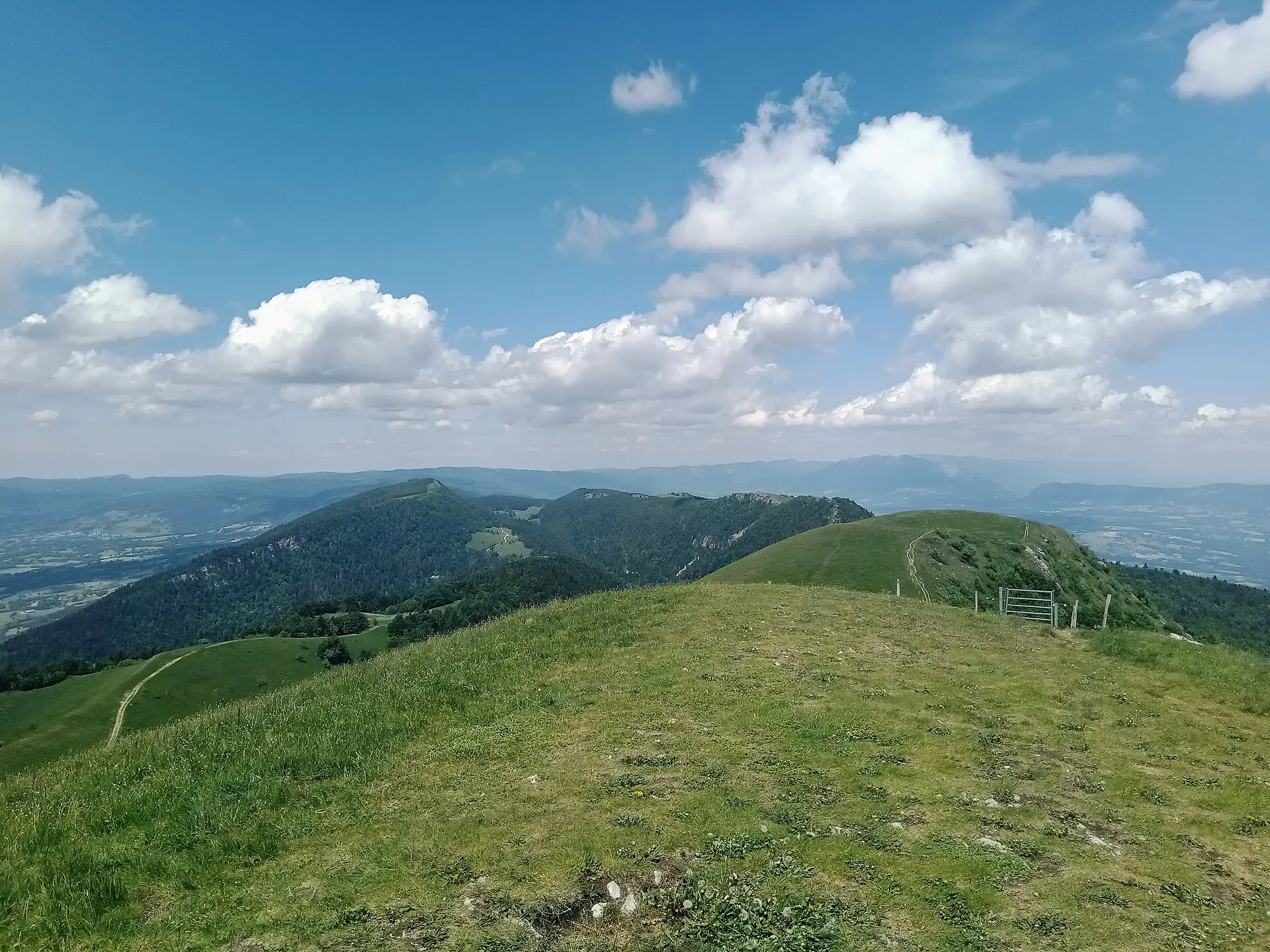

Beyond its legendary road, the Grand Colombier is a massif of ridges, forests and summer pastures that can be explored on foot. The Bugey Sud Grand Colombier tourist office describes eleven routes there, starting from the villages at the foot of the massif. This page sorts them by starting point and sets out the rules that apply on the pastures.
The shortest walk: the Cross from the pass
From the car park at the pass, the tourist office gives a round trip of about 20 minutes to the viewpoint indicator (table d’orientation) at the foot of the Cross (1,525 m according to Ain Tourisme). The view from there is 360 degrees. This walk depends on the road to the pass being open, which is not the case in winter.
The tourist office also mentions several walks of a few hours along the ridges, without giving their duration.
The eleven walks by starting point
The tourist office page we consulted on 9 November 2026 gives no times, distances or height gain for these routes. Each walk has its own listing, which you should check before setting off. We do not publish figures that we have not verified listing by listing.
| Starting point | Walks listed by the tourist office |
|---|---|
| Culoz-Béon | Le Grand Colombier from Culoz; Grand Colombier ridge circuit; Grand Colombier pasture trail; Scioux circuit; Chanduraz from Béon |
| Arvière-en-Valromey | Sur Lyand ridges; Sentier des Chartreux; Le Grand Colombier from Munet; Hergues ridges; Chanduraz circuit from Charaillin (Chavornay area) |
| Artemare | Walk around the foot of the Grand Colombier |
Culoz-Béon side
Five routes start from Culoz or Béon, on the Rhône side. This side, above Culoz, is also where you will find the Fenestrez viewpoint, at 1,150 m according to Ain Tourisme. As Culoz has a railway station, these starting points are the easiest to reach without a car.
Arvière-en-Valromey side
Five walks start from the commune (municipality) of Arvière-en-Valromey, which includes Virieu-le-Petit and Lochieu, on the Valromey side. The hamlet of Munet is the starting point for the route to the summit; our directory lists the Chez Cuzieu farm inn there.
The Sentier des Chartreux is the only route on this list whose detailed listing we have consulted: it starts at Les Bordèzes in Lochieu and covers 8.5 km in 3 hrs 30, with 570 m of height gain, according to the tourist office. It leads to the remains of the Arvière charterhouse (our detailed page on it is in French only for now).
Artemare side
One walk explores the foot of the massif from Artemare, starting in the valley.
Rules on the mountain pastures
The Grand Colombier’s summer pastures (alpages) are working areas for farmers and living space for the herds. The pass is also an Espace naturel sensible (a protected natural site of the Ain department) and the massif is part of Natura 2000 site FR8201642. The rules published by the tourist office and by Montagnes du Jura are as follows:
- Wild camping: not allowed on the pastures.
- Dogs: on a lead at all times.
- Fences and gates: close them behind you.
- Herds: avoid sudden movements; walk around cows standing on the path.
- Shepherd’s hut: private property, to be respected.
- Paths: stay on waymarked paths.
- Litter: leave no trace of your visit.
- Flowers: the walks page asks visitors not to pick wild flowers, while the tourist office’s main page tolerates picking a small number of narcissi and daffodils. As there is no single rule, it is better not to pick any.
The tourist office also provides a charter on sharing the pastures (charte de cohabitation en alpage) as a PDF.
Preparing your walk
The tourist office does not publish an equipment list. However, a few points follow from the available information:
- Carry your own water: there are no drinking-water points or toilets on the massif, where water is scarce according to the tourist office.
- Wear suitable footwear: the ridge and forest paths call for walking boots or shoes. The Sentier des Chartreux listing, for example, describes stony, earthy ground.
- Bring a warm, windproof layer: the ridges are exposed, and it is often cooler at the top than in the valley.
- Have a map or a GPS track: the Département de l’Ain publishes waymarked routes in its Ain Outdoor app.
- Check the road: the walk to the Cross and any walk starting from the pass depend on the access roads, which are closed in winter.
In winter
The roads to the pass are closed by the Département de l’Ain, usually from November to the second half of April. As of 9 November 2026, the closure date for winter 2026-2027 had not been published. According to Montagnes du Jura, the massif can then be explored on snowshoes and cross-country skis from the Sur Lyand Nordic area. The tourist office does not present the routes on this page as suitable in winter conditions.
To ride up to the pass rather than walk, see our page on cycling the Grand Colombier.